Fairfield Township is one of thirteen townships in Tippecanoe County, Indiana. As of the 2010 census, its population was 51,113 and it contained 24,527 housing units.
History
Ely Homestead, a historic home in Fairfield Township, was listed on the National Register of Historic Places in 1976.
Geography
According to the 2010 census, the township has a total area of 28.06 square miles (72.7 km2), of which 27.57 square miles (71.4 km2) (or 98.25%) is land and 0.49 square miles (1.3 km2) (or 1.75%) is water.
Cities and towns
- Lafayette (north three-quarters)
Unincorporated communities
- Eastwich at 40.4269799°N 86.8500088°W / 40.4269799; -86.8500088
- Birmingham at 40.4686463°N 86.8527872°W / 40.4686463; -86.8527872
- Elston at 40.3930913°N 86.9097315°W / 40.3930913; -86.9097315
- Tecumseh at 40.3928135°N 86.8683419°W / 40.3928135; -86.8683419
(This list is based on USGS data and may include former settlements.)
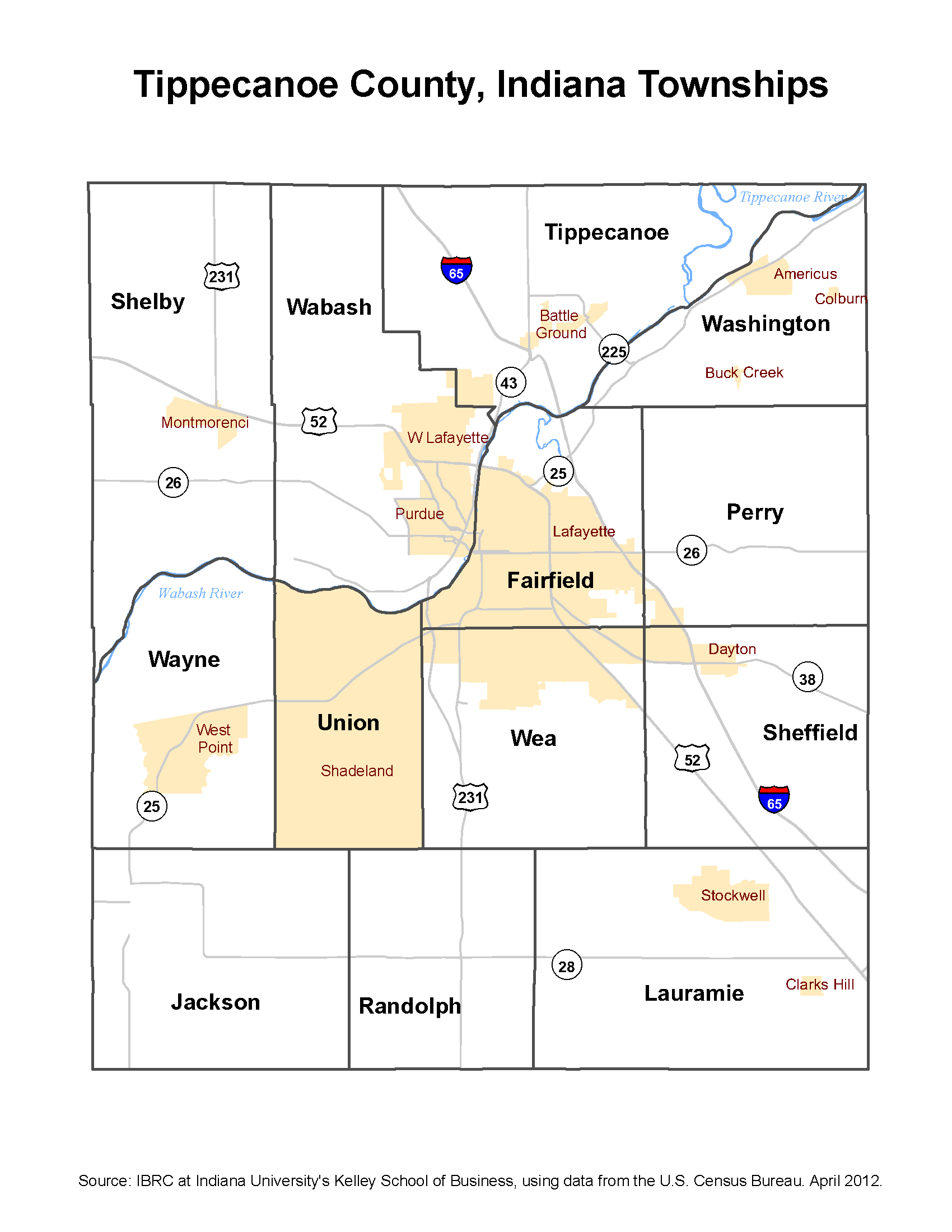
Adjacent townships
- Tippecanoe Township (north)
- Washington Township (northeast)
- Perry Township (east)
- Sheffield Township (southeast)
- Wea Township (south)
- Union Township (southwest)
- Wabash Township (northwest)
Cemeteries
The township contains ten cemeteries: Davis, Greenbush, Isley, Lafayette City Burial Grounds, Rest Haven Memorial Park, Sons of Abraham, Spring Vale, Saint Boniface, Saint Joseph's, Saint Marys, and Temple Israel.
Major highways
- Interstate 65
- US Route 52
- US Route 231
Airports and landing strips
- Aretz Airport (Closed since 1999)
School districts
- Lafayette School Corporation
- Tippecanoe School Corporation
Political districts
- Indiana's 4th congressional district
- State House District 26
- State House District 27
- State House District 41
- State Senate District 07
- State Senate District 22
References
- United States Census Bureau 2007 TIGER/Line Shapefiles
- United States Board on Geographic Names (GNIS)
- United States National Atlas
External links
- Fairfield Township
- Indiana Township Association
- United Township Association of Indiana